¬Ý
¬Ý
¬Ý
The different sedimentary records collected in trenches, in terraces and in lake along the fault will be correlated to get a reliable seismic and paleoclimatic history over at least the last 2000 years. By using together these complementary technique we will set up a unique data-base of paleo-earthquakes on the North Anatolian Fault. With this kind of data set we hope to answers essential questions about recurrence behavior of large earthquakes.
¬Ý
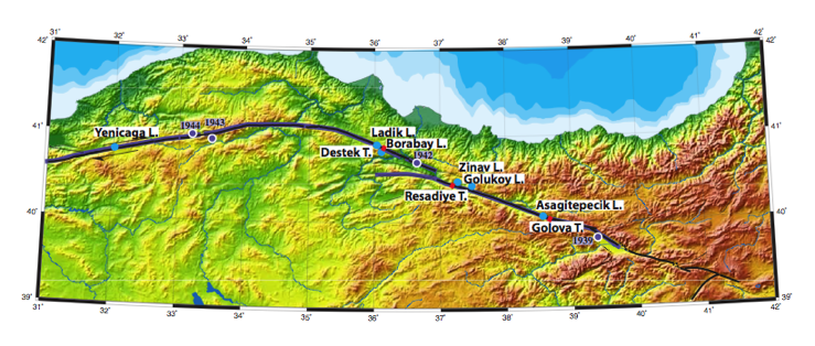
In the project, we plan to use a diverse array of complementary techniques involving trenching across the fault combined with subsurface geophysics, dating of displaced geomorphic features and drilling of lake sediments along the fault trace.

¬Ý
¬Ý